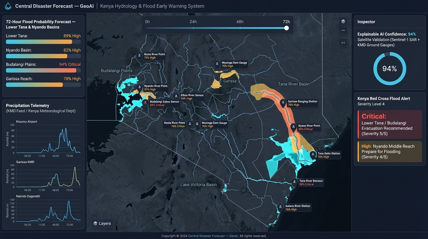
Central Disaster Forecast — GeoAI
A flood and disaster intelligence platform in development. People will be able to ask about a place, explore mapped risk and historical events, and see the data and uncertainty behind each answer.

Mapping with communities.
Building sustainable futures.
We work with communities to turn local knowledge, field surveys, earth observation, and spatial analysis into maps that support mobility, disaster preparedness, and better decisions.
Discuss a projectLived local knowledge is our structural foundation. Local youth and mappers verify spatial realities that satellite imagery alone cannot perceive.
We combine terrain analysis, SCS-CN runoff estimates, SWAT and HAND methods, and machine learning to develop and validate flood risk forecasts.
We favor transparent, reproducible methods and open data where appropriate. Community teams help validate, maintain, and use the maps built with them.
Atlas Geosystems supports the development of geospatial infrastructure in communities. We connect local needs with mapping expertise, practical technology, and partner networks so that communities can plan, adapt, and build resilience.
Build useful geographic data with communities and make it available for local planning and action.
Create maps that communities can understand, own, update, and use over time.
All five initiatives are in development. These images are interface mockups: locations, figures, verification badges and alerts are illustrative, not live project results. Outputs will be shared after production and partner review.
A flood and disaster intelligence platform in development. People will be able to ask about a place, explore mapped risk and historical events, and see the data and uncertainty behind each answer.
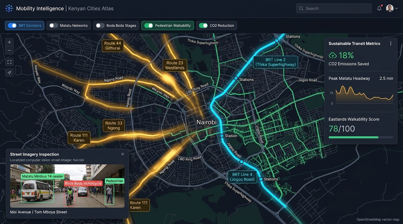
Mapping road, transit, and pedestrian networks with OpenStreetMap, street imagery, and local mobility knowledge to support sustainable urban planning.
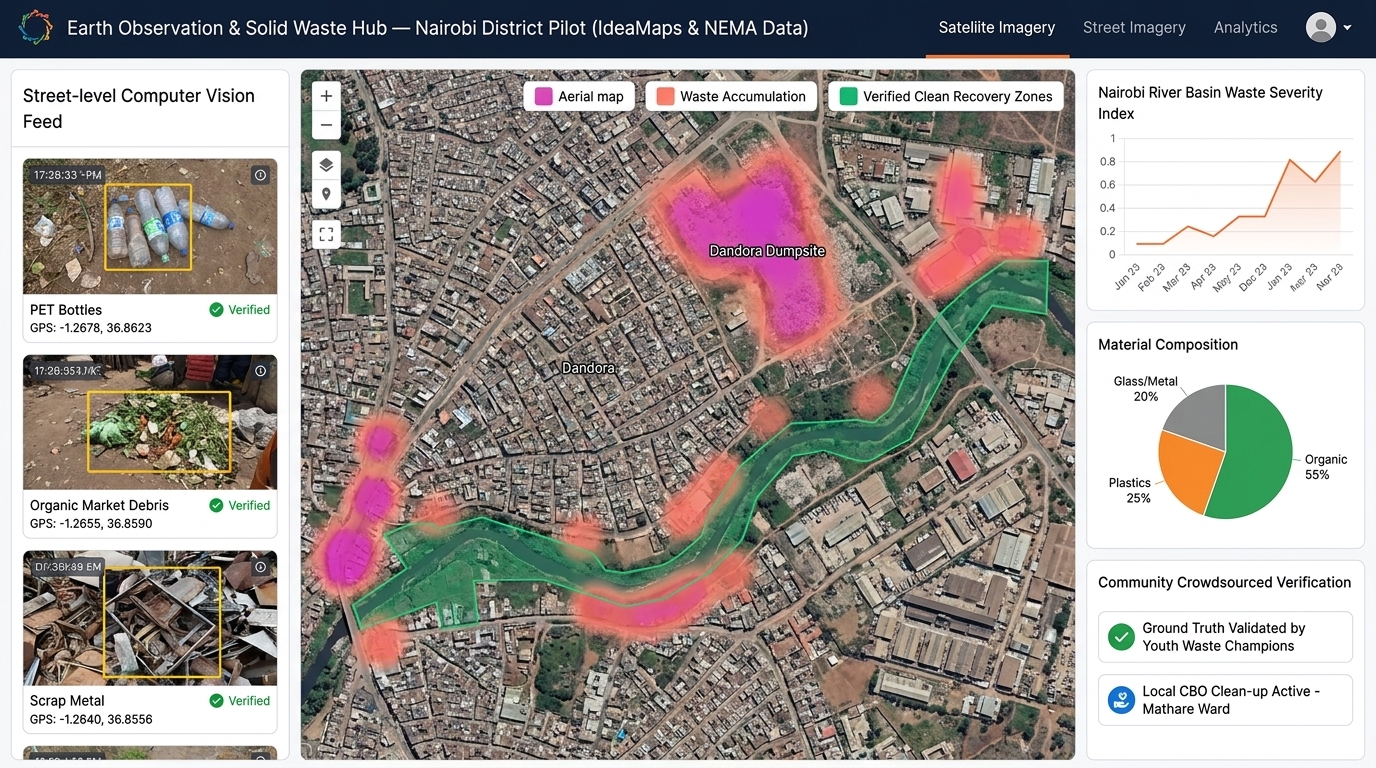
An IdeaMaps-inspired model combining Mapillary street imagery, Footpath.ai pedestrian data, and community verification to locate and monitor waste hotspots.
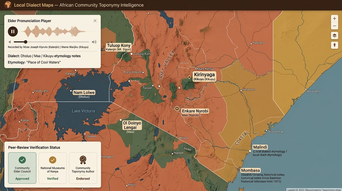
Documenting local place names, community boundaries, and spatial knowledge in the languages people use, with community members as authors and reviewers.
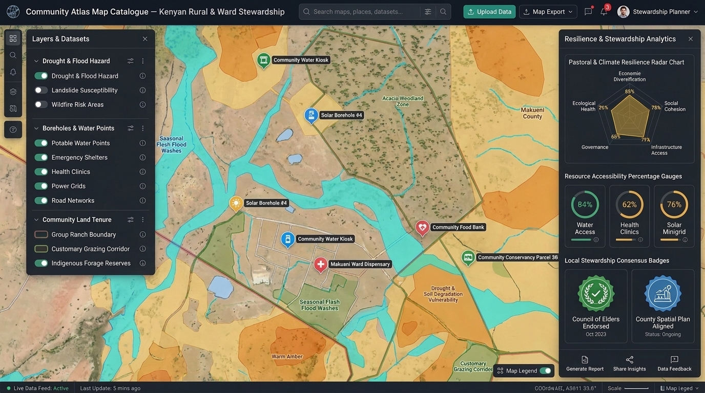
Living maps that bring together disaster risks, local resources, geographic boundaries, and socioeconomic indicators for community planning and stewardship.
"Disasters begin and end in communities. It is the people living there who understand the what, the where, and the when." We don't map communities — we map with communities.
Partner With UsFrom primary field data collection to predictive hydrological modeling and interactive web portals.
End-to-end spatial data acquisition using drone photogrammetry, GNSS receivers, satellite imagery, and community field teams across ASAL and riverine zones.
Online and in-person mapathons using OpenStreetMap and Mapillary. Training community members to generate verified spatial data.
Terrain and watershed analysis, SCS-CN runoff estimates, SWAT and HAND methods, with machine learning to develop flood forecasts and early warning intelligence.
Land use change analysis, urban planning support, infrastructure corridor assessments, and natural resource spatial intelligence.
Production of community atlas catalogues referenced to administrative borders, historical hazard data, and socioeconomic indicators.
Structured training curriculums for county governments, NGOs, and universities in GIS, drone piloting, and mapathon coordination.
Constructing transport community maps for sustainable urban mobility in Kenyan cities, integrating street view and pedestrian networks.
Leveraging Sentinel and Landsat imagery for vegetation monitoring, solid waste tracking, and multi-temporal change detection.
Interactive web-based map portals for visualizing disaster risks and resource distribution, built for local stakeholders and leaders.
Every Atlas Geosystems deployment follows a rigorous, community-anchored process.
Cataloguing historical records, satellite imagery, and hydrological stations.
Physical & virtual sprints with global contributors and local mappers.
Catchment runoff modeling using automated SWAT & HAND pipelines.
Publishing interactive portals and community map catalogues.
Post-event verification with community elders and county stakeholders.
Our approach is to agree on data use with local partners before collection, document decisions as projects develop, and return maps in forms community teams can maintain.
We discuss what will be mapped, who can use it, and which layers may be made public with participating communities and project partners.
We attribute contributions appropriately and review sensitive locations and personal information before any public release. Access is limited where sharing could cause harm.
We plan for usable files, clear documentation, and an agreed update process so local teams can steward atlas layers after a project handover.
Specific access, licensing, retention, and handover arrangements are agreed for each project.
We prioritize open data and reproducible tools, while using specialist platforms when a project needs them. We also train partners to use the resulting workflows.
We work with communities, public institutions, researchers, volunteers, and supporters to turn geographic knowledge into practical tools.
Build a local atlas, join a mapathon, or host a community studio for mapping and training.
Plan a community map →Bring geospatial intelligence into disaster plans, urban development, and resilience programs.
Discuss a public project →Join online or local mapping sessions. Training is available for people new to mapping.
Join a mapathon →Collaborate on hydrology, earth observation, participatory mapping, and GeoAI methods.
Explore research →Request practical GIS, drone, field data, disaster modeling, or mapathon training.
Request training →Support field surveys, community studios, open data, and disaster intelligence infrastructure.
Support the work →Tell us about a community mapping need, a flood risk question, a transport or waste mapping project, or a partnership. We welcome collaborations across Kenya and beyond.