
GeoAI for flood and disaster intelligence
We are developing a platform that will help people ask questions about flood risk in a specific place and understand the answer through maps, charts, source data and community knowledge. Floods are the first focus; the approach may later support other disasters.
Status: In development. This page describes the planned experience. The image below is an interface mockup with illustrative figures and alerts; no live flood forecast or public warning service is available here yet.
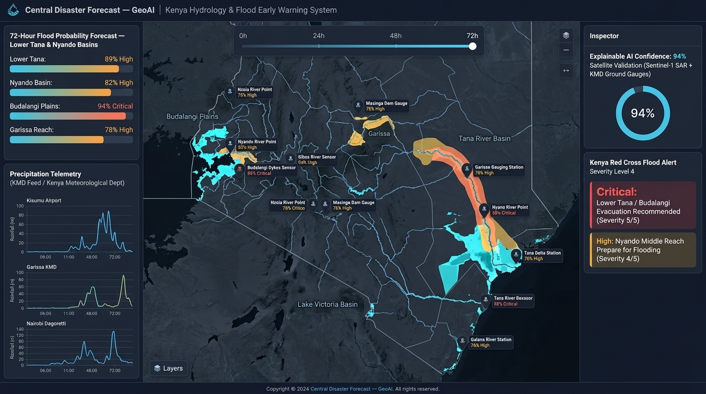
From a local question to an answer people can inspect.
A community member, planner or disaster team could ask: “Which areas of this watershed have flooded before, and what makes them more exposed?” GeoAI would organize the analysis around that place and question.
Locate
Confirm the area and timeframe, including local place names and community boundaries where available.
Analyze
Select suitable historical, terrain, rainfall and field data, then run defined geospatial and hydrological workflows.
Explain
Present a map and chart with source links, dates, assumptions and uncertainty, instead of an unsupported AI answer.
Validate
Invite local review and improve the analysis before it informs preparedness plans or wider sharing.
Risk maps, experimental forecasts and official alerts serve different purposes. Any warning capability would require demonstrated accuracy, operational partners and clear responsibility before use.
Five goals driving our disaster intelligence work
Comprehensive Disaster Database
Compile a database of open data sources covering past floods — historical records, geographical information, and hydrological station feeds.
ML Predictive Modeling
Evaluate hydrological and machine learning methods for flood exposure and, where suitable live data exists, test short-term forecasting against observed events.
Accessible Visualization Dashboard
Plan an accessible map-and-question workspace that shows results alongside their sources, dates, assumptions and uncertainty. This workspace is a later development phase.
Stakeholder Validation & Integration
Review model results with community members and local organizations, then work with responsible partners on any use in preparedness plans.
Community Atlas Map Catalogues
Create community atlas catalogues referenced to geographical delineations, historical data, and current disaster happenings — owned by the communities themselves.
Anywhere Disasters Happen
Starting with flood-prone communities and river basins, with methods designed for adaptation to other disaster risks where suitable data and local partners are available.
Why this work is urgent
Limited Predictive Capabilities
Despite advances in AI, geospatial technology, and data analysis, predictive models for which, where, and when the next disaster hits a specific community remain under-researched. Available models suffer from incomplete data, model uncertainty, and dynamic disaster scenarios.
The planned models will be tested and refined with local stakeholders as data becomes available, with uncertainty documented throughout development. We hope to celebrate "disasters that never happened."
Community at the Center
It is the people living in a community who understand the what, the where, and the when of disasters. They experience loss of livelihoods, infrastructure, and lives. Their knowledge is the most genuine and verifiable baseline for any spatial activity.
Community engagement initiatives encompass education, outreach programs, participatory mapping, and collaboration with local leaders — because the community is the first stakeholder.
Data Accessibility & Integration
Timely, relevant data from broad source spectrums is key for evidence-based decision-making. The initiative is designed to use open data sources such as OpenStreetMap and the Humanitarian Data Exchange alongside other datasets: historical disaster records, socioeconomic indicators, and geographical data.
Interoperable formats will help partners combine sources for risk assessment and model development.
Significance & Sustainability
The project aims to strengthen preparedness through risk analysis, capacity building, and future early warning tools. Community participation is planned across data collection, atlas creation, and model validation.
The approach is designed to be adapted to other communities and resource management challenges, with local ownership and ongoing model refinement.
Three phases from research to resilient communities
A structured roadmap moving from desktop modeling to full community deployment and atlas production.
Phase 1 — Research & Automation
Establish the scientific foundation and automate the core hydrological modeling pipeline before community deployment.
Phase 2 — Site & Community Deployment
Select test sites, engage community stakeholders, and validate models through participatory mapathons and field data collection.
Phase 3 — Community Atlas Production
Produce community-owned atlas map catalogues covering disaster risks and local resources for long-term use.